Angels Landing Hike
Zion National Park, Utah
Here are 16 photos from my hikes to Angels Landing in Utah's Zion National Park.
The hike begins at The Grotto (Shuttle Stop #6) and follows the West Rim Trail from the floor of Zion Canyon to Scout Lookout. This popular hike, which requires a permit, is famous for its last half mile to the summit of Angels Landing along a knife-edge trail with helpful chains in key spots. The full hike, which is not suitable for anyone with a fear of heights, is 5.4 miles (8.7 km) round trip with an elevation gain of 1,488 feet (453 meters).
For those who are not comfortable with the knife-edge trail, ending the hike at Scout Lookout, as many do, is still worthwhile - the view of Zion Canyon to the east is impressive (360° Google Street View). That hike would be 4.2 miles (6.2 km) round trip with an elevation gain of 1,000 feet (305 meters).
Another worthwhile alternative is to begin the trail toward Angels Landing, ascending the hill next to Scout Lookout. This gives you a taste of using the chains and eventually provides an excellent, if intimidating, view of Angels Landing, shown belown. You can then decided whether to proceed on the knife-edge trail to the summit, which yields even better views of the canyon, especially to the south.
Whether in addition to Angels Landing or as an alternative, consider hiking to Observation Point from the bottom of Zion Canyon, if possible. That hike is not as famous because it doesn't have a knife-edge trail with chains, but it is arguably more scenic and less crowded, although longer and more strenuous. Both hikes are outstanding, but I slightly prefer the one to Observation Point for its incredible views.
The first image below, created with Google Earth, shows the Angels Landing trail from Scout Lookout to the summit of Angels Landing. This view, which identifies points referenced in the photos, looks southeast.

Angels Landing Trail (Google Earth image)

Angels Landing and the Virgin River viewed near the beginning of the hike
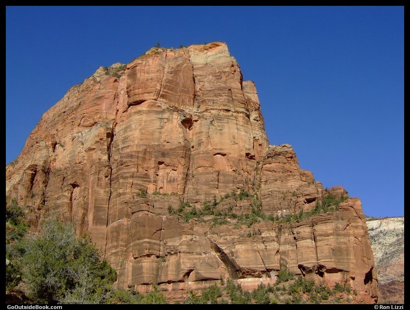
Angels Landing viewed from the West Rim Trail

The Great White Throne viewed from the West Rim Trail

Fall foliage in Refrigerator Canyon viewed from the West Rim Trail

Hikers on the switchbacks of Walter's Wiggles on the east side of Refrigerator Canyon on the West Rim Trail

The Great White Throne (left) and Angels Landing (obscured) viewed from Scout Lookout
The hill on the right is where the trail to Angels Landing and the chains begin.

Angels Landing viewed from the trail (Point A in first image)
The overexposed sky was replaced in this image.

Observation Point (peak left of center) viewed from Point B in first image

Angels Landing Trail ("Step of Faith" at lower left) viewed from Point B in first image

Hikers on Angels Landing Trail viewed from Point B in first image

Hikers on Angels Landing Trail viewed from Point B in first image

View of Angels Landing Trail looking back to Scout Lookout
Refrigerator Canyon is on the left.

Zion Canyon and Observation Point (peak at upper right) looking north from Angels Landing

Zion Canyon and Observation Point (peak at top) looking north from Angels Landing

Zion Canyon looking south from Angels Landing

The Great White Throne viewed from Angels Landing


